Satellite imagery is a common data in working for a geospatial project or just to look over a region how it is look like cause we have never been there. High resolution satellite gives such a detail view of the earth surface that enabled us to see every object on it. But sometimes the color contrast of the original image is not so good to differentiate each object. Therefore we need to enhance the image color to get a better contrast. This post will show you how to enhance satellite imagery color contrast as seen in figure 1.
 |
| Figure 1. Satellite Imagery Before and After Color Enhancement |
Here are the steps for satellite imagery color enhancement.
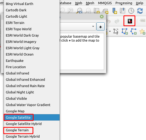
1. Using Tile+ plugin add Google Satellite and Google Terrain layer as seen in figure 2. Make sure to put Google satellite layer on the top of the terrain layer.
 |
| Figure 2. Adding Satellite Imagery and Terrain into QGIS |
2. Open Google Satellite properties, go to Symbology and set Layer Rendering option to Hard Light as seen in figure 3.
 |
| Figure 3. Satellite Imagery Properties |
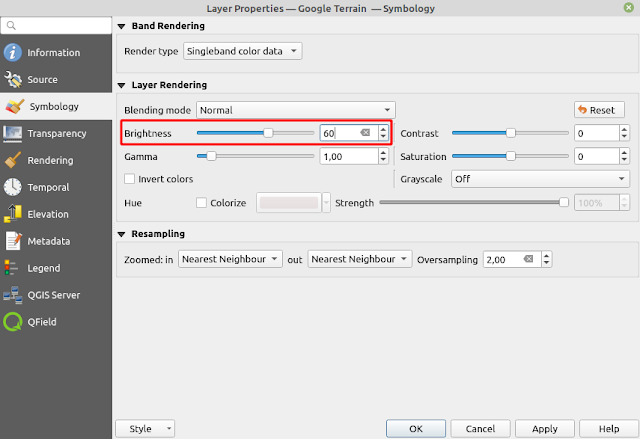
3. If you think the image is too dark. Open Satellite Terrain Properties and add the brightness. In the figure 4, I added the brightness to 60.
 |
| Figure 4. Set Image Brightness |
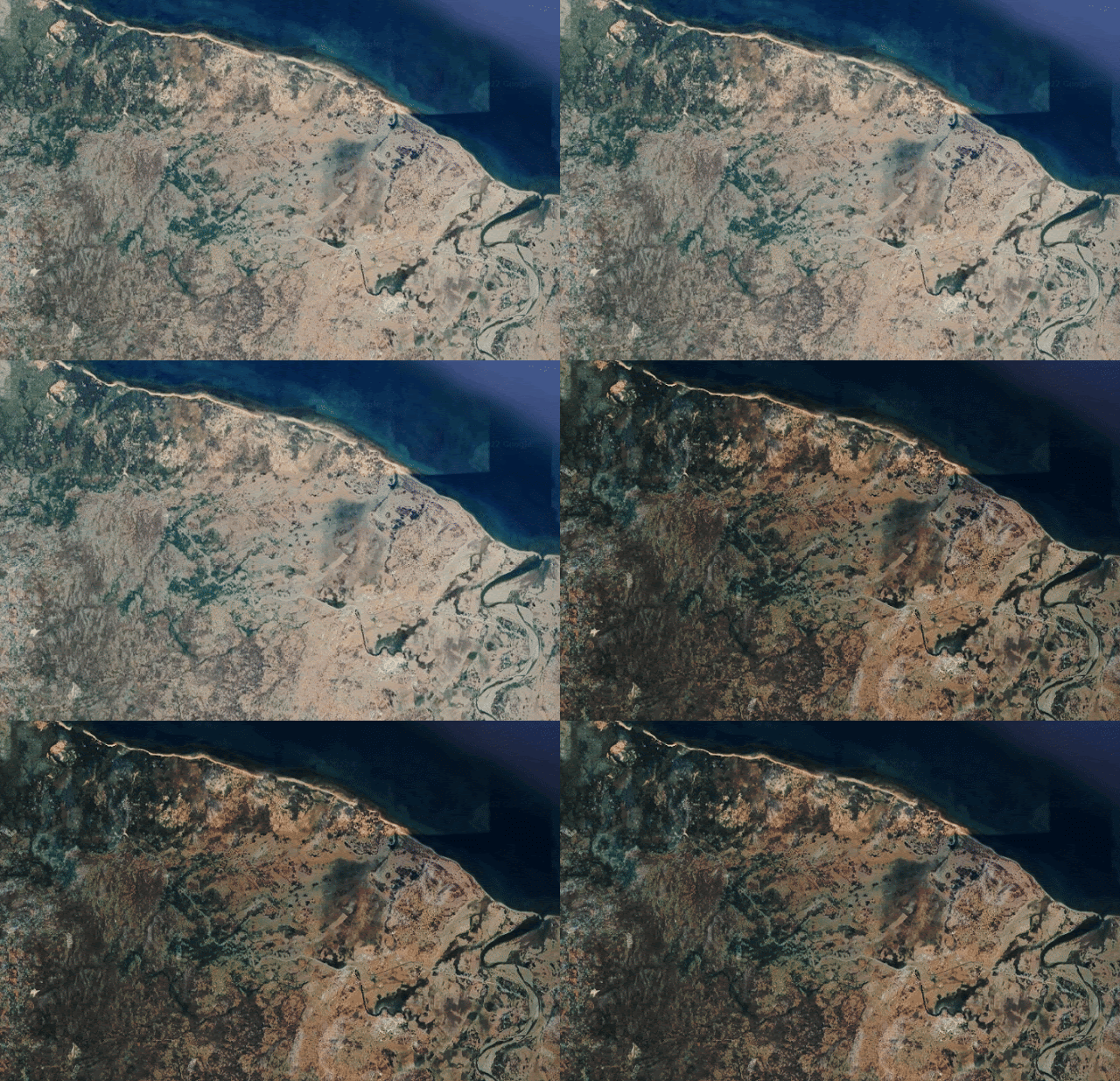
Now go around the satellite imagery, you should see now the color contrast is enhanced as shown in the figure 1 or in the animated figure 5 below.
 |
| Figure 5. Satellite Imagery Color Enhancement |
That's all this QGIS tips how to enhance satellite imagery color contrast. Just a little remark before closing this post. I had tried to enhance the color contrast directly using contrast and brightness option in the satellite imagery's properties, but I think it does not give a good result compared to the blending option. If you're interested for other interesting QGIS tips and tricks please visit QGIS Tips and Tricks series. Thanks!
